


|
Quantity
|
Total
|
||
|
|
|||
|
|
|||
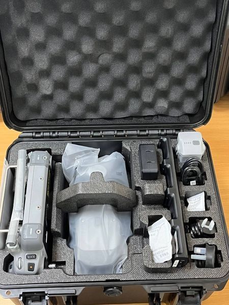
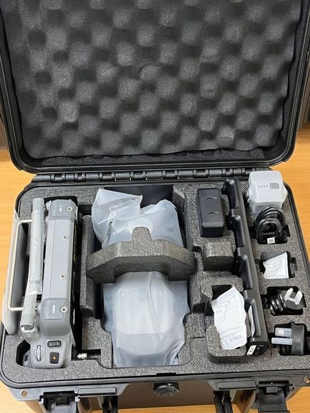
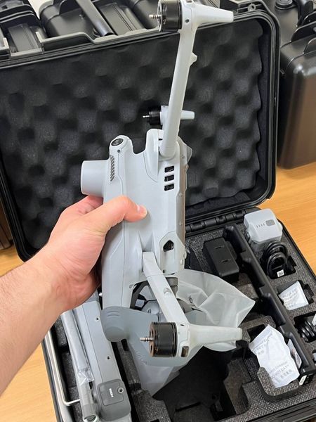
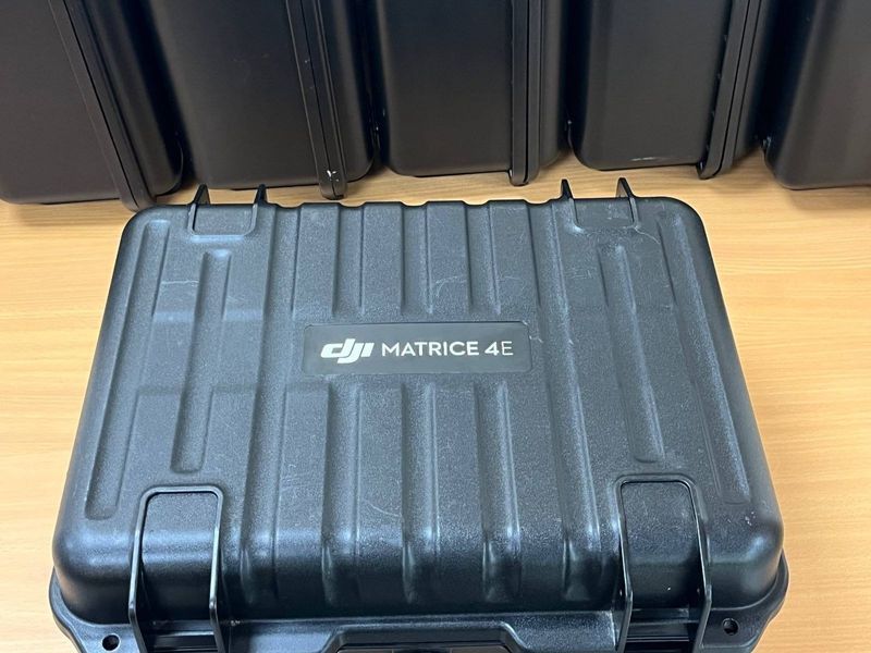
DJI Matrice 4E quadcopter
DJI Matrice 4E quadcopter is a professional industrial platform designed for surveying, territory monitoring, mapping, infrastructure inspection, energy sector operations, and aerial imaging. The platform is intended for professional users who require precision, reliability, and stable performance in demanding environments.
The quadcopter is equipped with a 20 MP wide-angle camera featuring a 4/3 CMOS sensor and mechanical shutter, along with additional 48 MP medium and tele cameras. An integrated laser rangefinder with a measurement range up to 1800 meters significantly expands inspection and measurement capabilities. RTK support provides highly accurate positioning for surveying and mapping operations.
DJI Matrice 4E supports GPS, GLONASS, BeiDou, and Galileo navigation systems, ensuring stable positioning even in complex conditions. Maximum flight time reaches up to 42 minutes with standard propellers, while speeds up to 21 m/s allow rapid coverage of large operational areas.
We are a team of veterans
For us, DJI Matrice 4E is especially interesting as a professional platform combining precise positioning, stable flight characteristics, and extensive capabilities for aerial monitoring, inspections, and mapping. The combination of RTK support, laser rangefinder, and multiple cameras allows efficient operation over large territories and complex infrastructure objects.
Flight stability, navigation precision, and reliable field operation are especially important. The large 4/3” sensor with mechanical shutter is highly suitable for mapping, topographic work, and analytical tasks, while the tele camera enables detailed imaging of distant targets.
For professional users, critical advantages remain transmission stability, operational endurance, and compatibility with professional surveying and inspection workflows.
Specifications
| Parameter | Value |
|---|---|
| Model | DJI Matrice 4E |
| Type | Professional quadcopter |
| Wide-angle camera | 4/3 CMOS, 20 MP |
| Medium camera | 48 MP |
| Tele camera | 48 MP |
| Mechanical shutter | Yes |
| Video resolution | 4K 3840×2160@30fps |
| Laser module | Up to 1800 m |
| RTK | Supported |
| GNSS | GPS + GLONASS + BeiDou + Galileo |
| Maximum flight time | Up to 42 min |
| Maximum speed | Up to 21 m/s |
| Maximum altitude | Up to 6000 m |
| Operational altitude with payload | Up to 4000 m |
| Frequency bands | 2.4 / 5.2 / 5.8 GHz |
| Gimbal | 3-axis stabilized gimbal |
| Weight | 1219–1229 g |
| Manufacturer | DJI |
Comment / comments
DJI Matrice 4E positions itself as a professional industrial platform for missions where positioning accuracy, stable flight performance, and high image detail are critically important. The large 4/3” sensor with mechanical shutter provides high quality visual data suitable for mapping, inspections, and surveying applications.
The integrated laser rangefinder significantly expands measurement and inspection capabilities, while RTK support enables integration into professional surveying workflows. The multi-camera system provides operational flexibility for both short and long distance observation tasks.
The platform is well adapted for real field conditions thanks to stable navigation performance, strong operational endurance, and reliable performance in demanding environments.
Who it is suitable for
Primarily for military units, quadcopter operators, reconnaissance teams, and territory monitoring specialists. Especially useful for missions requiring accurate positioning, stable aerial monitoring, and efficient operation over large areas.
Surveyors and mapping specialists receive a professional platform with RTK support, mechanical shutter capability, and high precision for map generation and terrain modeling.
Inspection and energy sector companies can use the platform for monitoring power lines, pipelines, technical infrastructure, and industrial facilities where image detail and operational range are critically important.
Construction and agricultural companies receive a versatile quadcopter suitable for territory monitoring, infrastructure assessment, and analytical operations.
Professional aerial imaging operators receive a stable platform with high quality optics, long flight endurance, and extensive professional capabilities for demanding operational scenarios.